Explorar las categorías
Explora
Fiverr Pro
Español
$
USD

Traducción automática
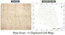
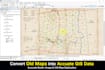
Yo georeferenciar mapas escaneados/rasterizados y digitalizar datos espaciales en capas de GIS precisas, listas para análisis, mapeo GIS o planificación.
Con más de 5 años de experiencia en GIS, utilizo ArcGIS y QGIS para entregar conjuntos de datos alineados con precisión y verificados en topología en WGS84 o en tu sistema de coordenadas preferido.
Lo que ofrezco:
Por qué trabajar conmigo:
Para comenzar, comparte por favor: mapa escaneado/imagen, sistema de coordenadas de destino y lista de capas necesarias.
Herramientas: ArcGIS Pro, QGIS
GIS Analyst CAD to GIS Expert
Idiomas
Traducción automática
Traducción automática
¿Qué formatos de mapas puedes georeferenciar?
PDF escaneados, JPG/PNG, imágenes satelitales, antiguas hojas topográficas, mapas históricos.
¿Qué sistema de coordenadas utilizas?
Cualquier — WGS84 es el predeterminado; dime tu CRS/datum requerido.
¿Proporcionan archivos fuente?
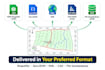
Sí, en Shapefile, GeoJSON o KML según sea necesario.


