Explorar las categorías
Explora
Fiverr Pro
Español
$
USD

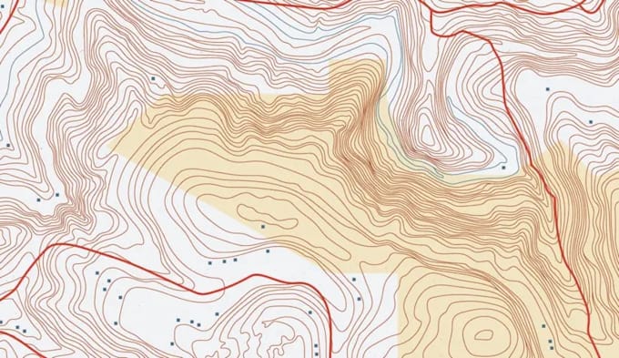
CUSTOM TOPOGRAPHY & CONTOUR MAP || DEM, ELEVATION & TERRAIN MAPPING
Looking for a precise, custom topographic map, contour map, or elevation/DEM dataset for your project, business, or personal use? You're in the right place.
What I Offer:
Software & Tools I Use:
ArcGIS / ArcGIS Pro, QGIS, Google Earth Pro, AutoCAD, Rhino + Grasshopper, Global Mapper
Before You Order:
Please send me your location/coordinates, desired contour interval, output format, and intended use (print, web, GIS, CAD) so I can quote accurately and avoid back-and-forth.
Let's turn your coordinates into a map worth using. Message me or hit order, and let's get started!
Informa al freelancer cualquier preferencia o inquietud que tengas con respecto al uso de herramientas de IA en la finalización y/o entrega de tu pedido.
Map Modeller
Idiomas
What information do you need to get started?
I'll need the location or coordinates (lat/long, place name, or a marked area on a map), your desired contour interval (e.g., 1m, 5m, 10m), the output format you need (PDF, DXF, SHP, PNG, etc.), and what you'll use the map for (printing, GIS project,
Can you map any location in the world?
Yes — as long as elevation/DEM data is publicly available for that area (which covers the vast majority of the globe), I can generate a topographic or contour map for it. Some remote or high-latitude areas may have lower-resolution source data; I'll flag th
What's the difference between a topographic map and a contour map?
A topographic map shows elevation, terrain features, and often additional details like land cover or hydrology. A contour map specifically shows elevation using contour lines (lines connecting points of equal elevation). I can deliver either, or both together, depending on your needs.
What file formats do you deliver?
Common formats include PDF, PNG, JPG (for print/visual use), DXF (for AutoCAD), SHP/GeoTIFF (for GIS use), and KML (for Google Earth). Let me know your intended use and I'll recommend the best format — or deliver multiple formats if needed.
Do you provide 3D or printable terrain models?
Yes, I can generate 3D terrain/relief representations suitable for visualization or preparing files for 3D printing. Let me know in advance so I can scope this correctly, as it's a separate process from standard 2D mapping.
Can you match a specific coordinate system or projection?
It depends on your terrain and purpose. Flatter areas or detailed engineering work usually need smaller intervals (1–5m); mountainous or large-area overviews work fine with 10–20m+. If you're unsure, tell me the size of your area and intended use, and I'll recommend an interval.
Do you provide the raw GIS data/layers, or just the final map image?
My standard packages include the final formatted map. Raw source layers, shapefiles, or editable project files can be provided as an add-on — just let me know if you need them.
