Haré animaciones 3d y mapas interactivos

S
smihigis
S
smihigis
Med Smihi

Level 1

Parte de la información se ha traducido automáticamente.

Acerca de este Servicio

Traducción automática

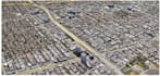
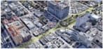
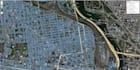
Realización de animaciones 3D creadas utilizando un DEM y una ortoimagen a través de ArcGIS Pro, así como mapas interactivos en OpenLayers y Leaflet APIs.

Los productos entregables son de alta calidad con una representación profesional.

Conoce a Med Smihi

Med Smihi
5.0(16)

Level 1

  • DeMarruecos
  • Miembro desdejun 2021
  • Responde aprox. en:1 hora
  • Última entrega3 semanas
  • Idiomas

    Árabe, Inglés, Francés
I'm a Remote Sensing & GIS engineer with consistent experience in GIS projects management and hydrology. I'm certified in ArcGIS & Erdas Imagine software. I put at your disposal my services at a reasonable price. In addition to that, i would like to inform you that i master traduction in the three languages listed below. UpWork Top Rated Freelancer.

Traducción automática

Etiquetas relacionadas