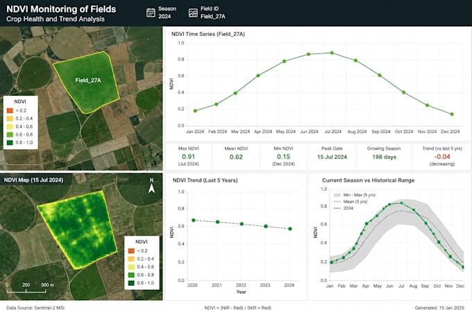
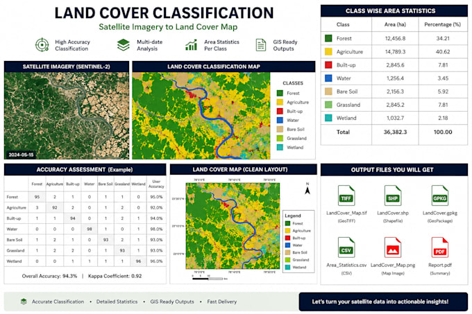
I am a remote sensing and GIS specialist focused on end-to-end geospatial automation. I build workflows for satellite image processing, NDVI monitoring, land cover analysis, change detection, and raster/vector data processing. I can automate data download, preprocessing, analysis, quality checks, and delivery using Python, QGIS, GDAL, Rasterio, GeoPandas, Google Earth Engine, and Apache Airflow. I help clients convert raw geospatial data into repeatable pipelines, maps, reports, and decision-ready outputs.... Lee más