Explorar las categorías
Explora
Fiverr Pro
Español
$
USD

An Experienced AutoCAD GIS Specialist
Habilidades
Revisa mis servicios
Document Controller (Remote Job)
XAD Technologies • Tiempo completo
Feb 2022 - Present • 4 yrs 5 mos
• Controlling company all types of documentation for Telecom projects. • Preparation of all types of survey documents before implementation for ISP and OSP operations. • Preparation of final reports on completion of Implementation and installation of all types of Telecom equipment’s from Shelter to Customer. • Ensuring all documentation meets formal requirements and required standards. • Sorting, storing and retrieving electronic documents. • Organize and distribute documents with the project team and management. • Ensure documents are shared at key times to facilitate timely project completion. • Following and improving document control procedures.
GIS/CAD Specialist
Communicator's Globe Pvt. Ltd • Tiempo parcial
Oct 2020 - Present • 5 yrs 9 mos
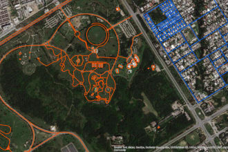
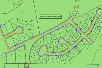
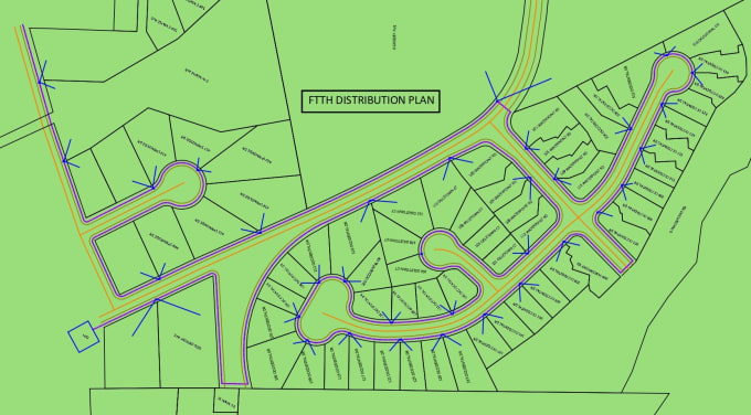
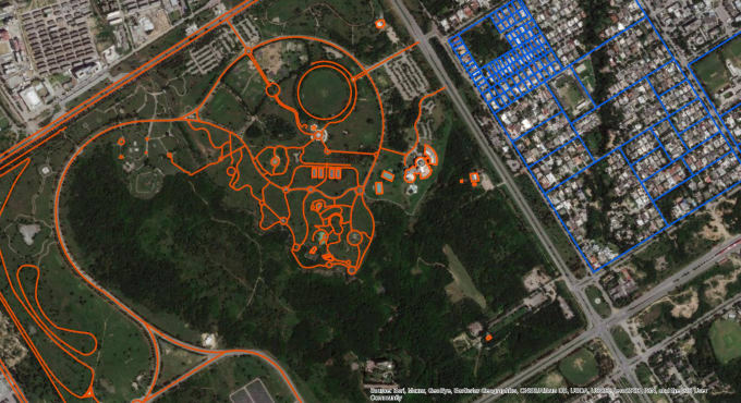
• Created, Edited, and maintained drawings utilizing AutoCAD & GIS. • Preparation of Architectural Drawings for Construction Projects utilizing AutoCAD. • Preparation of OFC Metro & Long-Haul Fiber Route maps. • Preparation of As Built and Proposed Route Drawings for (Jazz, Telenor, Zong, PTCL) etc. • Preparation of ROW Diagrams for deferent Govt. (NHA, PHA, Pak Railways) Departments • Geographical area Maps for telecom services utilizing Google Earth, Global Mapper, ArcMap. • Digitization in GIS and Google earth, Process Data for Maps. • Preparation of CAD Drawings, KMZs for OFC Laying Projects.
GIS Officer
DATA SOLUTIONS Pvt. Ltd. • Tiempo completo
Feb 2011 - Mar 2014 • 3 yrs 1 mo
• Preparation of Cities Detailed Geographic Navigation Maps utilizing GIS Applications • Digitization, Data Processing, Marking of POIs, and Inserting Data into Geographic Maps. • Collection of Real time Data, Coordinates Using GPS and Camera during the Survey. • Calibration of Camera data with GPS Data to mark the accurate location on Google Earth. • Data loading into Manifold, GIS Maps.
| (2) | ||
| (0) | ||
| (0) | ||
| (0) | ||
| (0) |
kenronen

Reino Unido
cikeorha

Estados Unidos
Very excellent. didn't respond in time due to TIME ZONE DIFFERENCES but when he did, HE WAS FLAWLESS and accurate with the delivery. He asked questions to clarify before working on the project...HIGHLY RECOMMENDED.

Respuesta del Freelancer