Explorar las categorías
Explora
Fiverr Pro
Español
$
USD

gis expert
Habilidades
Revisa mis servicios
GovernanceWorx
Tiempo completo • 2 yrs 9 mos
GIS Specialist
Mar 2024 - Dec 2025 • 1 yr 9 mos
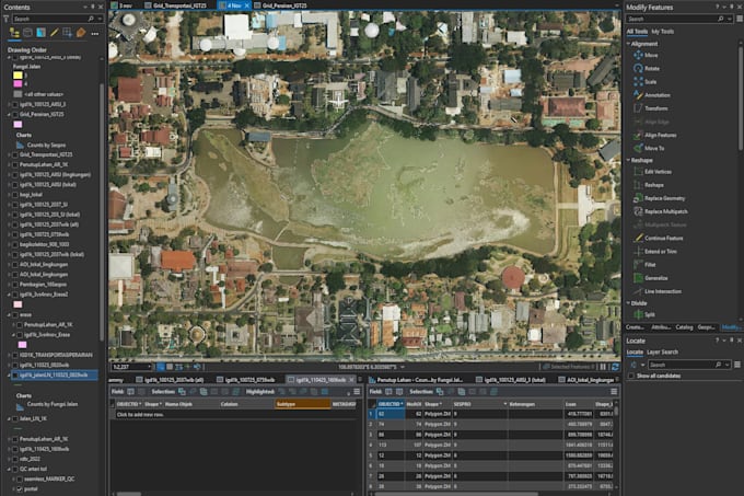
• Led technical teams in the development and updating of Fundamental Geospatial Information (IGD) and Thematic Geospatial Information (IGT). • Supervised and validated spatial data to ensure zero topology errors and attribute consistency based on BNSP standards. • Developed and implemented New Data Processing SOPs, significantly increasing team workflow efficiency. • Oversaw the integration of multi-source data (Satellite Imagery, UAV/Drone, Field Surveys) into a centralized spatial database.
Senior GIS Analyst (Team Leader)
Sep 2022 - Sep 2023 • 1 yr
• Managed the quality of spatial outputs for the National Strategic Project: Complete Systematic Land Registration (PTSL-PM) in Pacitan, East Java.• Directed the production of Thematic Land and Spatial Maps (PTPR) for forest boundary areas in Merangin, Jambi. • Provided technical mentorship and training to junior staff on advanced GIS instrumentation and precision digitization techniques.
