s
sankheakash

Akash Sankhe

@sankheakash

I am a Civil Engineer specializing in UAV photogrammetry and spatial mapping

India
Inglés, Maratí, Hindi
Parte de la información aparece en idioma inglés.
Sobre mí
Civil Engineer & Spatial Data Specialist delivering survey grade spatial data and UAV photogrammetry solutions. With 3+ years of experience, I transform raw aerial imagery into accurate 3D models, topographic maps, and CAD deliverables using Agisoft Metashape and Pix4D. My expertise includes PPK/GCP positioning, stockpile volumetrics, and vector extraction for engineering projects. Additionally, I design custom, fully editable Canva templates combining technical precision with clean aesthetics to create branded business documents, presentations, and marketing collateral. Send a message anytime... Lee más

Habilidades

s
sankheakash
Akash Sankhe
desconectado • 
Tiempo medio de respuesta: 1 hora

Revisa mis servicios

Modelado y renderizado 3D
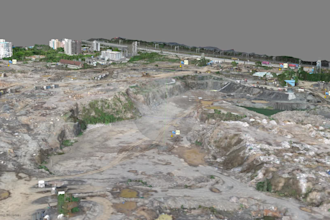
I will process drone images into survey grade 3d orthomosaic maps and models
Banners y publicaciones para redes sociales
I will design custom and editable canva templates for any project

Porfolio

Experiencia laboral

Immunity_Group

Surveying or Spatial Science Technician

Immunity Group • Tiempo completo

Dec 2022 - Present • 3 yrs 10 mos

Civil Engineer and Spatial Data Specialist managing drone photogrammetry, rock extraction tracking, and volumetric mapping for stone quarry operations. Key Responsibilities & Achievements: a) Conducted regular UAV aerial mapping over stone quarrying sites to generate high-resolution orthomosaics and Digital Surface Models (DSM). b) Processed dense point clouds to calculate accurate cut-and-fill calculations, rock bench elevations, and aggregate stockpile volumes. c) Integrated Ground Control Points (GCPs) and GNSS positional data to maintain survey-grade spatial accuracy across rugged quarry terrain. d) Delivered actionable terrain maps and 3D elevation models to optimize site safety, bench planning, and overburden volume tracking.