Explorar las categorías
Explora
Fiverr Pro
Español
$
USD

Level 1


Traducción automática
Bienvenido,
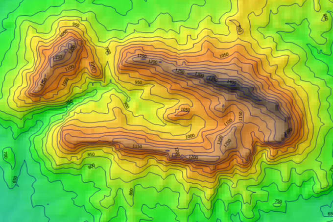
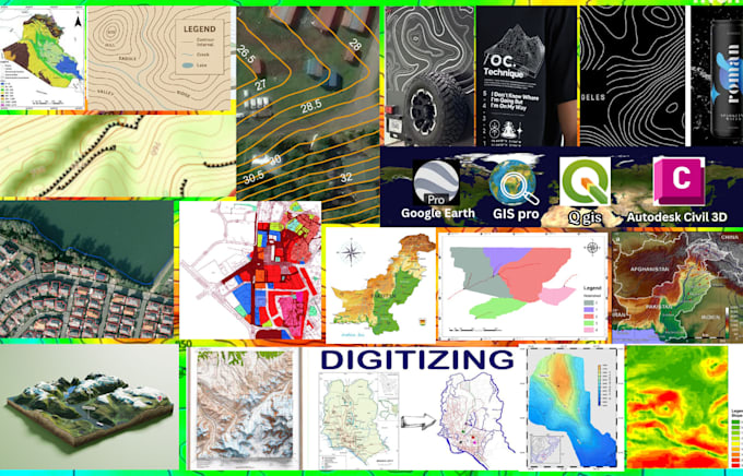
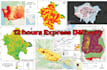
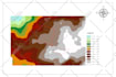
CONTORNOS DE NIVEL, ELEVACIONES y MAPAS TOPOGRÁFICOS GIS 2D y 3D
Hola, soy ArcGIS Professional y tengo experiencia diversa en mapeo 2D/3D, mapas topográficos, contornos, análisis espacial, mapeo de datos vectoriales, digitalización, análisis hidráulico, modelado 3D, análisis del terreno, georreferenciación de imágenes y
Rectificaciones. Si deseas servicios relacionados con este tipo de actividades, estás en el lugar indicado.
Cada mapa constaba de las siguientes características;
Y muchos más
Adquisición de DEM, DSM, DTM (modelo de elevación como raster o vectorial) de cualquier zona del mundo.
¿Por qué necesitas elegir mi servicio?
Estoy aquí para ayudarte, si tienes algún problema o consulta en el mapeo y contorno de ArcGIS solo envíame un mensaje.
TOPOGRAPHY, GEOLOGY AND ArcGIS SPECIALIST
Level 1
Idiomas
Traducción automática
Traducción automática
¿Proporcionará un trabajo de calidad dentro del tiempo establecido?
Sí, proporcionaré un trabajo de calidad.
| (28) | ||
| (3) | ||
| (2) | ||
| (1) | ||
| (0) |
nouraans

Arabia Saudita
should have been better at the work
Hasta USD50
$
2 días
Tiempo

Respuesta del Freelancer
mat_wra

Polonia
All good! Highly recommended.
USD50-USD100
$
2 días
Tiempo

Respuesta del Freelancer

american_15

Estados Unidos
The freelancer delivered exactly what I needed — detailed terrain maps, slope analysis, contours, and properly formatted KML/KMZ files for Google Earth. They were responsive, flexible with adjustments, and the final results were clear and well-organized. Highly recommended for any topography or GIS mapping project!
USD50-USD100
$
4 días
Tiempo

wardabenamar

Bélgica
The topographic work was carried out with great precision and professionalism. Everything was clearly understood from the start, which allowed for a quick and efficient completion. Excellent attention to detail and very responsive throughout the process.
Hasta USD50
$
1 día
Tiempo
Respuesta del Freelancer
projectyonder

Reino Unido
Communication and delivery was very fast! Would you Rizwan again.
Hasta USD50
$
4 días
Tiempo

Respuesta del Freelancer
| (28) | ||
| (3) | ||
| (2) | ||
| (1) | ||
| (0) |
nouraans
Arabia Saudita
should have been better at the work
Hasta USD50
$
2 días
Tiempo
Respuesta del Freelancer
mat_wra
Polonia
All good! Highly recommended.
USD50-USD100
$
2 días
Tiempo
Respuesta del Freelancer
american_15
Estados Unidos
The freelancer delivered exactly what I needed — detailed terrain maps, slope analysis, contours, and properly formatted KML/KMZ files for Google Earth. They were responsive, flexible with adjustments, and the final results were clear and well-organized. Highly recommended for any topography or GIS mapping project!
USD50-USD100
$
4 días
Tiempo
wardabenamar
Bélgica
The topographic work was carried out with great precision and professionalism. Everything was clearly understood from the start, which allowed for a quick and efficient completion. Excellent attention to detail and very responsive throughout the process.
Hasta USD50
$
1 día
Tiempo
Respuesta del Freelancer
projectyonder
Reino Unido
Communication and delivery was very fast! Would you Rizwan again.
Hasta USD50
$
4 días
Tiempo
Respuesta del Freelancer