Explorar las categorías
Explora
Fiverr Pro
Español
$
USD


Hello!
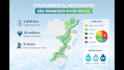
I will create a professional Study Area Map for your thesis, dissertation, or scientific research using GIS and QGIS.
Study area maps are commonly required for:
Master thesis
PhD dissertations
Scientific papers
Environmental reports
Geography and GIS research
Your map can include:
Study area boundary
Administrative boundaries
Rivers and lakes
Roads and cities
Coordinate grid
Scale bar
North arrow
Professional legend
Software used:
QGIS (Geographic Information System)
You will receive:
High-resolution PNG map
Publication-ready PDF
Professional cartographic layout
Optional GIS source file (Premium)
Please send the location, coordinates, or shapefile of your study area before ordering.
Feel free to contact me if you have any questions!
Informa al freelancer cualquier preferencia o inquietud que tengas con respecto al uso de herramientas de IA en la finalización y/o entrega de tu pedido.
I create maps for your academic research, publications, portfolios, and various
Idiomas
What do you need to create the study area map?
I need the location of the study area. You can send coordinates, a shapefile, a KML file, or simply the name of the place.
Can this map be used in a thesis or scientific article?
Yes. The maps are created with a professional cartographic layout and are suitable for academic publications, research papers, and dissertations.
Which software do you use?
I use GIS software such as QGIS to produce accurate and professional maps.
What file formats will I receive?
You will receive high-resolution PNG or PDF files. Source GIS files can also be included in the Premium package.
Can you create maps for any country?
Yes. I can create study area maps for any location worldwide using GIS data.


