Explorar las categorías
Explora
Fiverr Pro
Español
$
USD

Level 2


Hi, I'm Rashid
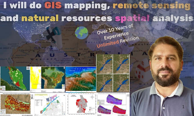
I am a GIS & Remote Sensing specialist with 10+ years of experience in geospatial analysis, natural resource mapping, environmental assessment, geological hazard, disaster management, and infrastructure projects. I deliver professional, high-quality solutions tailored to your needs using tools like ArcGIS, QGIS, GEE, ERDAS, Global Mapper, and AutoCAD.
Services I Offer:
I deliver professional solutions to ensure your satisfaction. Available 24/7 and tailored to your budget. Contact me today for services with superior accuracy and timely results.
Earth Explorer Geologist!
Level 2
Idiomas
Which GIS software/tools are you using?
FME, ArcGIS Suite, ArcGIS Enterprise, QGIS, Python
Can you help me find data sources for my project?
Yes, I will assist in sourcing open data and preparing the required datasets for your project.
| (9) | ||
| (1) | ||
| (0) | ||
| (1) | ||
| (0) |
oliverj09

Reino Unido
Excellent experience! Highly professional, knowledgeable, and detail-oriented. The work was accurate, well-presented, and delivered on time. Great communication throughout. I highly recommend this geoscientist and would gladly work with them again.
Hasta USD50
Precio
1 día
Tiempo

Respuesta del Freelancer
judylynn44

Estados Unidos
Very pleased that the assignment was completed prior to the due date.
USD100-USD200
Precio
4 días
Tiempo
Respuesta del Freelancer
crepin_96

Alemania
Professionalism
USD100-USD200
Precio
5 días
Tiempo
chrisfagan13
Cliente recurrente
Estados Unidos
Rashid Menhas Geoscientist did a wonderful job with this project. I would strongly recommend his work. Thank you!
USD200-USD400
Precio
4 días
Tiempo
laurent20
Cliente recurrente

Ruanda
Impressive understanding of geology, minerals, and GIS techniques. Great experience and highly recommended
USD50-USD100
Precio
10 días
Tiempo
| (9) | ||
| (1) | ||
| (0) | ||
| (1) | ||
| (0) |
oliverj09
Reino Unido
Excellent experience! Highly professional, knowledgeable, and detail-oriented. The work was accurate, well-presented, and delivered on time. Great communication throughout. I highly recommend this geoscientist and would gladly work with them again.
Hasta USD50
Precio
1 día
Tiempo
Respuesta del Freelancer
judylynn44
Estados Unidos
Very pleased that the assignment was completed prior to the due date.
USD100-USD200
Precio
4 días
Tiempo
Respuesta del Freelancer
crepin_96
Alemania
Professionalism
USD100-USD200
Precio
5 días
Tiempo
chrisfagan13
Cliente recurrente
Estados Unidos
Rashid Menhas Geoscientist did a wonderful job with this project. I would strongly recommend his work. Thank you!
USD200-USD400
Precio
4 días
Tiempo
laurent20
Cliente recurrente
Ruanda
Impressive understanding of geology, minerals, and GIS techniques. Great experience and highly recommended
USD50-USD100
Precio
10 días
Tiempo