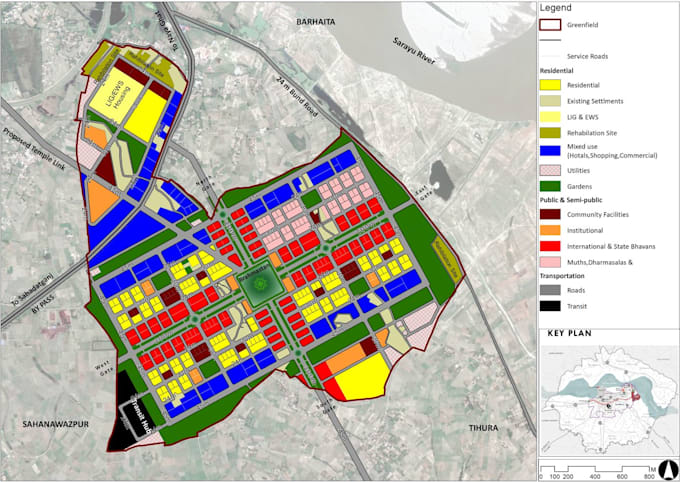
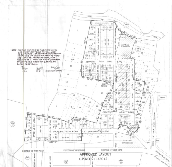
i will convert old auto cad or scanned Plans to Gis ( arc gis, qgis).
I will platting the data in to satellite image or Google earth
Herramienta
Esri
Conoce a Rama K
Rama K
DeIndia
Miembro desdemar 2020
Idiomas
Telugu, Inglés, Hindi
Mostly I have used these desktop applications to do GIS tasks.
ArcGIS, Envi, Erdas Imagine, QGIS
I have Worked With These GIS Formats
(Shapefile, Geotiff, DEM, GeoJSON, CSV and other GIS Formats)
Services:
1. Digitization using satellite Imagery, Landuse/ Landcover Extraction
2. Spatial Interpolation by IDW, Kriging interpolation
3. Hydrology, Terrain Analysis, Trend Analysis, Watershed, Viewshed analysis Using High-Resolution DEM data.
4. DGPS,PPK Data Processing,Lider data Analysis
5. Data downloading, management correction Like Atmospheric Correction Satellite