Explorar las categorías
Explora
Fiverr Pro
Español
$
USD

Level 1
Traducción automática
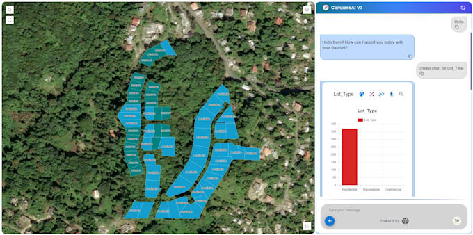
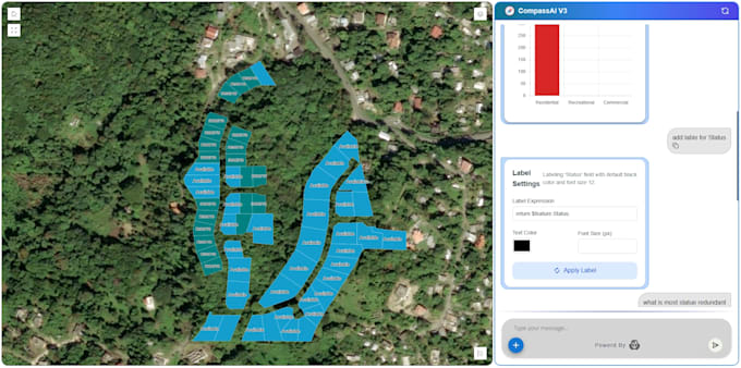
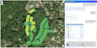
Construiré un chatbot de AI GIS personalizado que pueda analizar datos geoespaciales, responder preguntas espaciales y ofrecer insights inteligentes en mapas. Ya sea que uses Shapefiles, GeoJSON, PostGIS o datos de tierras/fincas, creo un asistente GeoAI similar a CompassAI que se integra con tus flujos de trabajo y ayuda a automatizar tus tareas de GIS.
Level 1
Idiomas
Traducción automática
Traducción automática
¿Con qué tipo de datos GIS puede trabajar tu AI chatbot?
A: El chatbot puede trabajar con Shapefiles, GeoJSON, KML, tablas PostGIS, datos raster (DEM, TIFF), mapas de fincas/tierras y cualquier documento geoespacial utilizado en tu flujo de trabajo.
¿El chatbot generará mapas o solo respuestas en texto?
A: Sí, el paquete Premium soporta análisis basado en mapas y puede generar insights relacionados con coordenadas, capas, elevación y más. También puede hacer referencia a tus datos GIS para respuestas precisas.
¿Puedes integrar el chatbot con mi base de datos o sistema GIS existente?
A: Sí. Puedo integrar con PostGIS, bases de datos SQL, herramientas CRM, APIs o servidores internos según tu paquete.
¿En qué plataforma funcionará el chatbot?
A: Puede funcionar en tu sitio web, WhatsApp, Telegram o como una aplicación web independiente, dependiendo de tus necesidades y paquete.
¿Proporcionas el código fuente?
A: El código fuente solo está incluido en el paquete Premium. Puede añadirse a otros paquetes como un servicio adicional.
¿El chatbot soportará múltiples idiomas?
A: Sí. La compatibilidad multilingüe está disponible en los paquetes Estándar y Premium, o como complemento.
¿El chatbot puede funcionar sin conexión o en un servidor local?
A: Sí. Puedo configurar una versión local/sin conexión dependiendo de tus requisitos y modelo elegido (pueden aplicarse tarifas adicionales).
¿Ayudas con el despliegue y la configuración?
A: Absolutamente. Ofrezco soporte para el despliegue en la plataforma de tu elección (sitio web, servidor, nube o máquina local).