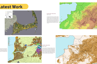
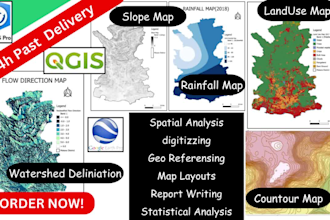
Hi! I’m Lahiru, a Civil & Environmental Engineer and GIS-based analysis researcher with over one year of industry experience. I specialize in GIS and environmental analysis, including cartography, satellite image analysis, hydrological modeling, and spatial analysis. I deliver accurate, practical solutions using QGIS, ArcGIS, Python, and SPSS. Let’s turn your data into meaningful insights—feel free to message me to discuss your project.... Lee más