p
peterdaud41

Peter D

@peterdaud41

Remote sensing and GIS Expert

Tanzania
Inglés, Suajili
Parte de la información aparece en idioma inglés.
Sobre mí
I am a GIS and Remote Sensing specialist with strong experience in QGIS, spatial analysis, and environmental modelling. I specialize in creating high-quality maps and performing geospatial analysis for agriculture, water resources, and land management. I have experience in land suitability analysis, DEM processing (slope and elevation), and satellite image analysis using tools like QGIS and Google Earth Engine. I am committed to delivering accurate and professional GIS solutions tailored to client needs.... Lee más

Habilidades

p
peterdaud41
Peter D
desconectado • 
Tiempo medio de respuesta: 1 hora

Revisa mis servicios

Consulta de Data Analytics
I will do gis mapping and spatial analysis using qgis, arcmap and google earth engine

Porfolio

Experiencia laboral

water resource engineer (research assistant )

Tanzania Safaris • Tiempo completo

Dec 2022 - Present3 yrs 5 mos

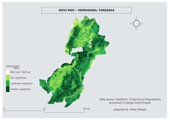
I work as a GIS and Engineering Research Assistant, focusing on spatial data analysis, mapping, and environmental modelling. I use QGIS and remote sensing techniques to support agricultural research, irrigation planning, and land suitability analysis. My work includes processing satellite data, performing DEM analysis (slope and elevation), and developing GIS-based solutions for water resources management and agricultural productivity.