Explorar las categorías
Español
$
USD
Conecta tu IA a Fiverr
Remote Sensing and GIS Specialist, GEE, Environment Science
Habilidades
Revisa mis servicios

Graduate Trainee / Dissertation Scholar (Surface Water Resources Division (SWRD), Remote Sensing Applications Centre, Uttar Pradesh (RSAC-UP), India)
Government of Uttar Pradesh • Trabajador autónomo
Jul 2025 - Jun 2026 • 11 mos
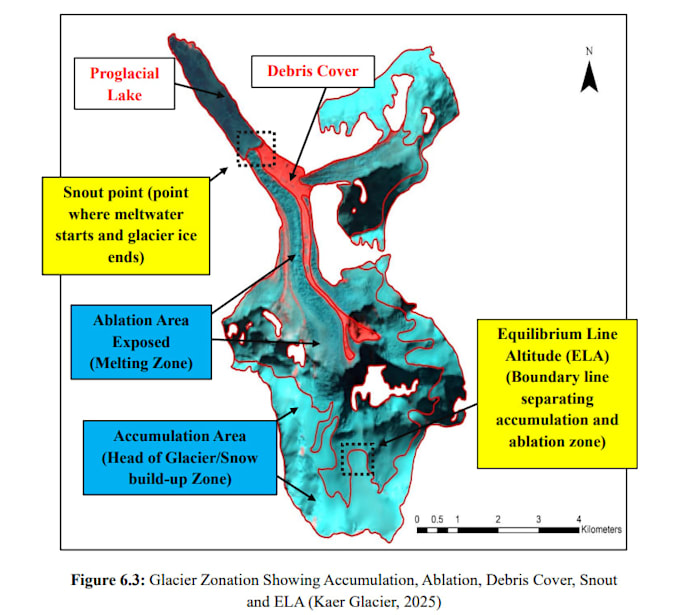
• Conducted glacier inventory, dynamics, and volume-change assessment across the Arun and Tamor sub-basins (Kosi Basin). • Processed multi-temporal satellite imagery and DEMs using ArcGIS, QGIS, ERDAS Imagine, SNAP, and Google Earth Engine (GEE). • Mapped glacier boundaries, quantified area and volume loss, and analyzed correlations with climatic stress. • Authored technical findings leading to conference proceedings publication and presentation.

Remote Sensing & GIS Intern
Govt Service • Trabajador autónomo
Jun 2025 - Aug 2025 • 2 mos
• Conducted satellite imagery analysis for vegetation classification and land-cover mapping using geospatial tools. • Performed Vegetation Health Mapping and Analysis using GEE.
