Explorar las categorías
Español
$
USD
Conecta tu IA a Fiverr

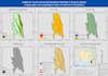


Looking for high-precision Digital Elevation Model (DEM) processing, watershed delineation, hydrological modeling, or flood inundation mapping in ArcGIS Pro, QGIS, and Google Earth Engine (GEE)?
I provide publication-grade 300 DPI topographic, morphometric, and hydrological maps tailored for academic research, engineering, and environmental management.
Core Terrain & Hydrological Services:
- Morphometric & Terrain Modeling: Elevation, Slope, Aspect, Hillshade, Contour lines, Curvature & Topographic Position Index (TPI) using Copernicus/SRTM/ALOS DEM.
- Watershed & Basin Delineation: Automated sink filling, flow direction, flow accumulation, pour point snapping, catchment boundaries & sub-basins.
- Drainage Network Analysis: Strahler & Shreve stream ordering, stream density, and basin morphometry.
- Flood & Erosion Modeling: Sentinel-1 SAR radar flood inundation mapping, Flood Hazard Zonation, and RUSLE soil loss modeling.
Deliverables:
- 300 DPI publication-ready maps (PNG, JPEG, PDF, TIFF)
- Processed DEM rasters, stream/basin shapefiles & statistical tables
Contact me with your study area before placing an order!
GIS, Remote Sensing and Geospatial Data Analyst
Idiomas
Which DEM datasets do you use for terrain and watershed analysis?
I routinely use 30m Copernicus DEM, USGS SRTM, ALOS PALSAR (12.5m/30m), ASTER GDEM, or any high-resolution LiDAR/drone DEM provided by the client.


