Explorar las categorías
Explora
Fiverr Pro
Español
$
USD

Level 1

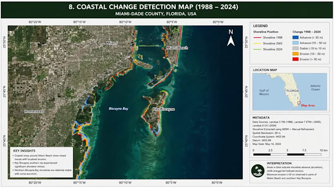
Transform raw location data into actionable insights with expert GIS, Remote Sensing, and GIS Mapping services. I deliver advanced spatial analysis, terrain modeling, and publication-ready cartography using ArcGIS, QGIS, and Python automation. Whether you need satellite imagery classification, land-use change detection, network routing, or custom geoprocessing scripts, I convert complex datasets into clear visual intelligence. My workflow guarantees strict topological accuracy, optimized geodatabases, and seamless data integration for environmental, urban planning, and business intelligence projects. I process shapefiles, GeoJSON, LiDAR, NDVI, spatial statistics, and enterprise databases. I specialize in high-resolution orthomosaic generation, hydrological modeling, suitability analysis, and automated batch processing workflows. Deliverables include print-ready layouts, interactive dashboards, and automated Python toolboxes tailored to your exact specifications. Every project features precise georeferencing, clean metadata, and rapid turnaround for academic or commercial use. Order now for professional geospatial solutions that drive smarter decisions. Lets map your success today!
GIS and Remote Sensing Specialist
Level 1
Idiomas
Do I need to provide the spatial data, or can you source it?
You can provide your own data (Shapefiles, GeoTIFFs, CAD, CSVs). If you lack data, I can source high-quality open-source satellite imagery, OpenStreetMap data, or public government datasets needed for your project.
Which software will you use: ArcGIS, QGIS, or Python?
I choose the best tool for your needs. ArcGIS for enterprise workflows, QGIS for open-source flexibility, and Python for advanced automation and complex spatial analysis. I adapt to your preferred ecosystem.
What file formats will I receive upon completion?
Deliverables are tailored to you. I provide standard vector formats (Shapefile, GeoJSON, KML, Geodatabase), rasters (GeoTIFF), high-res map layouts (PDF, PNG, JPEG), and Python scripts (.py) or Jupyter Notebooks.
What specific remote sensing and satellite analysis do you offer?
I offer Land Use/Land Cover (LULC) classification, NDVI/vegetation analysis, change detection, supervised/unsupervised classification, orthomosaic generation, and multispectral image processing.
Can you write custom Python scripts to automate my GIS tasks?
Yes! I write custom Python scripts using ArcPy, PyQGIS, GeoPandas, and Rasterio. I automate repetitive geoprocessing, batch data conversions, and complex spatial analyses to save you time.
How long does it take to complete a GIS mapping project?
It depends on complexity. Simple maps take 1-2 days, while complex remote sensing or Python automation takes 3-5 days. Message me with your requirements for an exact timeline!
Is my spatial data and project information kept confidential?
Yes, 100%. I take data privacy seriously. All your datasets, proprietary info, and deliverables are kept strictly confidential and never shared with third parties without your permission.
What if I need changes to the final map layout or analysis?
Your satisfaction is my priority. I offer revisions to ensure map symbology, layout, labels, legends, and analysis results perfectly match your requirements. Check my packages for revision limits.
Can I use your deliverables for academic or commercial projects?
Yes! I provide publication-ready maps and accurate spatial analysis perfect for academic theses, research papers, urban planning, environmental consulting, and commercial business intelligence.
My project is unique and complex. How do we get started?
Every project is unique! Message me with your details, objectives, and data needs. I will review them and send a custom offer tailored exactly to your scope and budget before you order.