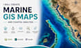
I will create professional gis maps using qgis and arcgis

M
mah238
M
mah238
MahmoudGIS
Parte de la información aparece en idioma inglés.

Acerca de este Servicio

Professional GIS Mapping Services

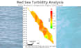
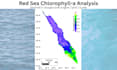
Need accurate and professional GIS maps for your project? I can help you create high-quality, visually appealing, and publication-ready maps using QGIS, ArcGIS and Surfer.

I provide customized GIS mapping solutions for environmental, marine, urban, research, and business projects with attention to detail and cartographic standards.


My services include:

  • Professional GIS map creation
  • Thematic and cartographic maps
  • Spatial data visualization
  • Digitizing and georeferencing
  • Raster and vector data processing
  • Shapefile editing and map layout design
  • Coordinate systems and map projection setup
  • High-resolution maps for reports, presentations, and publications


Deliverables:

  • High-quality JPG, PNG,SHP, GPKG, GeoJSON, KML/KMZ, GeoTIFF, DXF, DWG, CSV, XLSX and PDF maps
  • Professional layouts with legend, north arrow, scale bar, and coordinates
  • Editable GIS files upon request


Why choose me?

  • Accurate and professional work
  • Fast delivery
  • Clear communication
  • 100% customer satisfaction


Please contact me before placing an order to discuss your project requirements and ensure the best results.

Preferencia de estilo de entrega

Informa al freelancer cualquier preferencia o inquietud que tengas con respecto al uso de herramientas de IA en la finalización y/o entrega de tu pedido.

Conoce a MahmoudGIS

MahmoudGIS

GIS and Remote Sensing Specialist

  • DeEgipto
  • Miembro desdefeb 2021
  • Responde aprox. en:1 hora
  • Idiomas

    Árabe, Inglés
Hello! I'm Mahmoud, a GIS & Remote Sensing Specialist with experience in GIS mapping, satellite image analysis, spatial analysis, and marine GIS. I work with QGIS, ArcGIS, Google Earth Engine, Surfer, and Python to deliver accurate, high-quality geospatial solutions. I have published two scientific research papers and am committed to providing reliable work, clear communication, and on-time delivery. Let's turn your geospatial ideas into professional results.

Mi porfolio