Explorar las categorías
Español
$
USD
Conecta tu IA a Fiverr

Vetted Pro
Level 2
GIS Expert, Remote Sensing, Data Analyst, FME, Graphic Design, Excel Analytics,
El equipo de Fiverr Pro seleccionó a Malik Fahad por su experiencia.
Revisado para
Visualización de Datos
Habilidades
Revisa mis servicios
¿Quieres trabajar por horas?
Dile a Malik Fahad qué necesitas.
USD 50
/
hora
GIS Expert
Fiverr • Freelance
Dec 2017 - Present • 8 yrs 11 mos
I am writing to express my interest in GIS, Geospatial Data, and Digital Transformation opportunities within your organisation. With over 15 years of experience across mining & exploration, oil & gas, utilities, and infrastructure sectors, I bring extensive expertise in enterprise GIS, data management, and business process automation. I have successfully designed and implemented GIS solutions integrating geological, drilling, geochemical, remote sensing, and field datasets into enterprise platforms using ArcGIS Enterprise, ArcGIS Pro, and cloud technologies. My work has supported exploration targeting, resource evaluation, asset management, and operational decision-making. In addition to GIS, I have strong expertise in Microsoft technologies, including Power Apps, Power Automate, SharePoint, and Power BI, delivering digital solutions that streamline workflows, automate processes, and provide real-time business insights. My experience also includes ETL automation with FME, data engineering, and integration of spatial and enterprise systems, creating scalable architectures that support digital transformation initiatives. I have led multidisciplinary teams and delivered complex projects across Saudi Arabia, the UAE, and Pakistan, working effectively with government and private-sector stakeholders. With more than 50 professional certifications from Esri, Safe Software, Leica Geosystems, and other industry leaders, I remain committed to innovation through GeoAI, advanced analytics, and digital twin technologies. I am particularly interested in applying my combined GIS, data platform, and automation expertise to support smarter, data-driven operations within your organisation. Thank you for your consideration. I look forward to discussing how I can contribute to your team.
| (25) | ||
| (0) | ||
| (0) | ||
| (0) | ||
| (1) |

tclarke8633

Estados Unidos
kimib123

Emiratos Árabes Unidos


phoenixdronepro
Estados Unidos
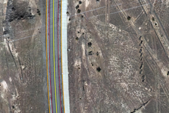
the finished orthomosaic was exactly what the customer needed. thanks
2 días
Tiempo
Sistemas de información geográfica (GIS)
gov_tuzi_2026

Montenegro
gov_tuzi_2026
Montenegro