Explorar las categorías
Explora
Fiverr Pro
Español
$
USD


Traducción automática
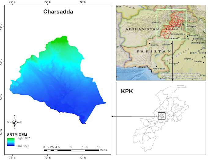
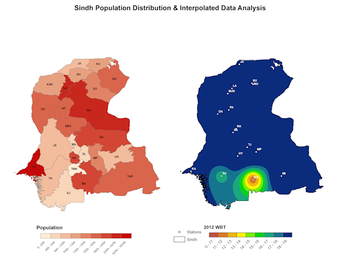
Soy un analista de GIS y teledetección con experiencia práctica usando ArcGIS y Python para análisis espacial, mapeo y procesamiento de datos. Trabajo con una amplia variedad de conjuntos de datos, desde datos ambientales y geográficos hasta información meteorológica y climática, transformando datos en bruto en mapas limpios, precisos y significativos.
Mi enfoque está en hacer el trabajo correctamente: datos limpios, análisis precisos y resultados fáciles de entender y listos para usar.
En qué puedo ayudarte
Si trabajas con mapas, datos espaciales o imágenes satelitales y necesitas alguien que maneje el aspecto técnico sin complicar las cosas, aquí estoy para ayudarte.
GIS and Remote Sensing Analyst
Idiomas
Traducción automática
Traducción automática
¿En qué tipo de proyectos trabajas?
Trabajo en una amplia variedad de proyectos de GIS, teledetección y datos espaciales, incluyendo mapeo, análisis espacial, procesamiento de imágenes satelitales y visualización de datos. Esto puede ser para investigación, informes, planificación o análisis general — sin limitarse a un campo específico.
¿Solo trabajas con datos de clima o meteorológicos?
No. Aunque tengo experiencia con conjuntos de datos meteorológicos y climáticos, también trabajo con datos espaciales, ambientales, geográficos y satelitales en general. Si tu proyecto involucra mapas o análisis espacial, no dudes en preguntar.
¿Con qué formatos de datos puedes trabajar?
Puedo trabajar con la mayoría de los formatos comunes de datos y datos espaciales, incluyendo Shapefile, GeoTIFF, NetCDF, CSV, Excel y conjuntos de datos raster/vector. Si no estás seguro sobre tus datos, puedes enviarme un mensaje primero.
¿Qué herramientas usas?
Principalmente trabajo con ArcGIS y Python para análisis espacial, mapeo, automatización y procesamiento de datos. También utilizo técnicas de teledetección según los requisitos del proyecto.
¿Puedes crear mapas listos para publicación o mapas profesionales?
Sí. Creo mapas limpios, profesionales y listos para presentación, adecuados para informes, artículos de investigación y presentaciones.
¿Aceptas proyectos personalizados o complejos?
Por supuesto. Muchos proyectos de GIS y teledetección son únicos, así que puedo revisar requisitos personalizados y ofrecer una solución adaptada.
¿Necesito comunicarme con usted antes de realizar un pedido?
Es muy recomendable. Un mensaje rápido me ayuda a entender tus datos y expectativas, y asegura que elijamos el paquete adecuado para tu proyecto.
¿Explicarás los resultados si no soy técnico?
Sí. Con gusto explicaré los resultados en términos simples y fáciles de entender, especialmente si eres nuevo en GIS o análisis espacial.
¿Mis datos se mantienen confidenciales?
Sí. Todos los datos del cliente se tratan como confidenciales y solo se usan para tu proyecto.