Explorar las categorías
Explora
Fiverr Pro
Español
$
USD

Level 1
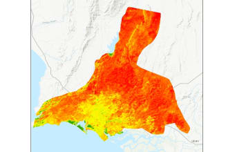
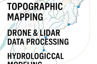
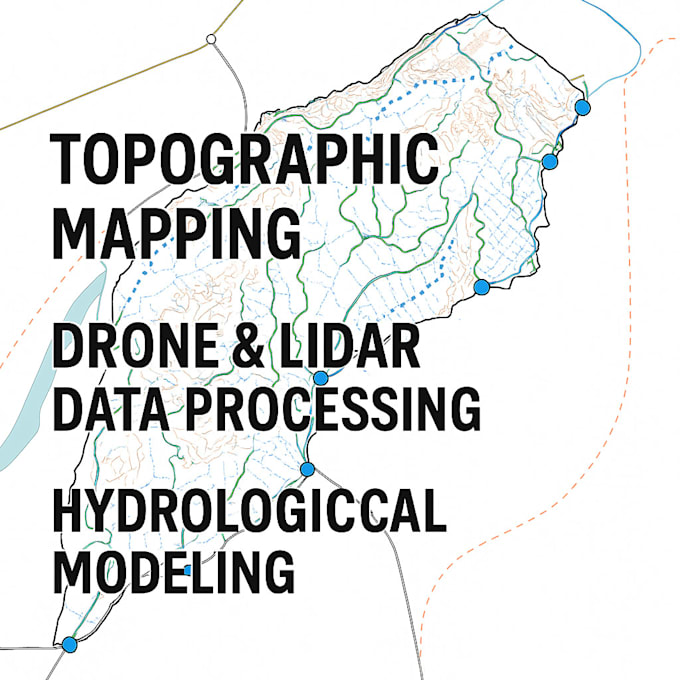
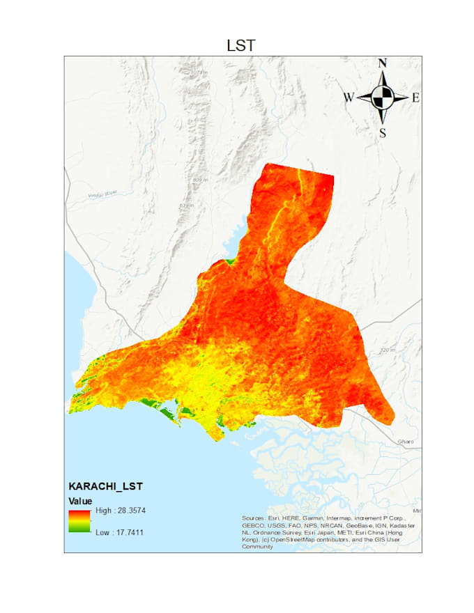
CREATE, UPDATE, ANALYZE AND MAINTAIN SPATIAL DATA
Habilidades
Revisa mis servicios
¿Quieres trabajar por horas?
Dile a Ijlal Farrukh qué necesitas.
USD 15
/
hora| (13) | ||
| (1) | ||
| (0) | ||
| (0) | ||
| (0) |

eliasayyoub

Emiratos Árabes Unidos
Thanks the delivery was as per my requirements! I will not hesitate to work with you again
vantage_james
Cliente recurrente

Estados Unidos

vantage_james
Cliente recurrente
Estados Unidos
Quick turn around and fantastic job
vantage_james
Cliente recurrente
Estados Unidos
kgspellacy
Estados Unidos
Delivered as expected, ahead of schedule.