f
flhiru

Laahiru

@flhiru
5.0(4)

Drone Mapping, GIS Related Works, Graphic Design

Sri Lanka
Parte de la información aparece en idioma inglés.
Sobre mí
I am a GIS Technician and IT professional with experience in GIS mapping, drone photogrammetry, data visualization, and computer support. My services include: 🗺️ GIS mapping, digitization, georeferencing, ArcGIS & QGIS 🚁 Orthomosaics, DEM/DSM, contour maps, 3D models & point clouds 📊 Data processing, cleaning, conversion & visualization 💻 Computer hardware, software & IT support 🎨 Graphic design and image editing I focus on accuracy, quality, and client satisfaction. Let's bring your ideas and data to life!... Lee más

Habilidades

f
flhiru
Laahiru
desconectado • 

Revisa mis servicios

Sistemas de información geográfica (GIS)
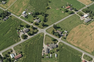
I will process drone images into orthomosaic, dem and 3d models
5.0(4)
Sistemas de información geográfica (GIS)
I will create gis maps and convert kml kmz shp CSV gps data

Experiencia laboral

Government_Agency

GIS Technician

Government Agency • Tiempo completo

Dec 2020 - Present • 5 yrs 11 mos

"As a GIS Technician, my primary responsibilities included digitizing paper maps, maintaining spatial attribute data, conducting field surveys using GPS, and updating spatial datasets in ArcGIS."

4 Reseñas
5.0

(4)
(0)
(0)
(0)
(0)
Desglose de calificaciones
  • Nivel de comunicación del Freelancer
    5
  • Calidad de la entrega
    5
  • Valor de la entrega
    5
1-4 de 4 reseñas
Ordenar por
Más relevante