Explorar las categorías
Explora
Fiverr Pro
Español
$
USD
GIS Expert, Remote Sensing Specialist, Data Analyst, AI ML Specialist, Drone Pil
Habilidades
Revisa mis servicios
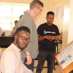
GIS DATA ANALYST - IN '"EARTHTREE"- Funded BY AstraZeneca - a Partner Company
AstraZeneca • Tiempo completo
May 2024 - Oct 2025 • 1 yr 5 mos
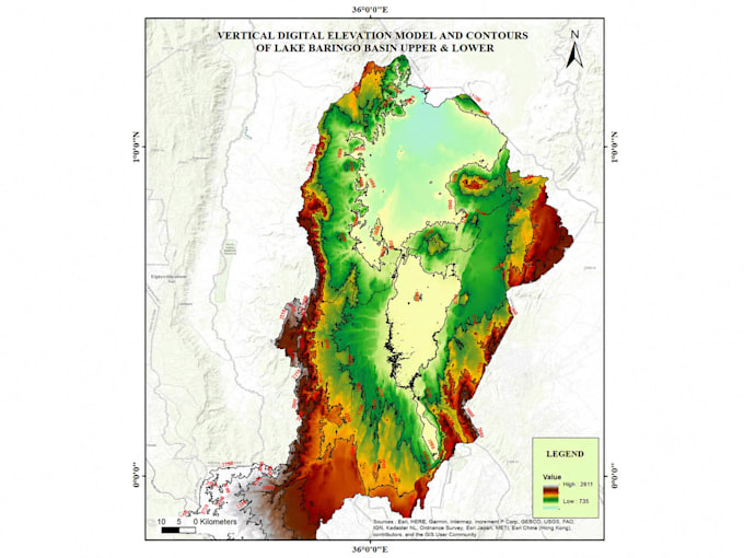
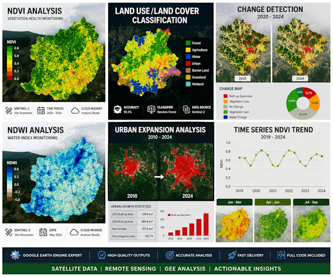
Served as GIS Data Analyst at Earthtree (an AstraZeneca-partnered carbon afforestation initiative), supporting large-scale carbon project development across Kenya through advanced geospatial analysis and remote sensing. Key Achievements: Led land suitability assessments using LULC classification and slope analysis in QGIS and Google Earth Engine, providing critical spatial intelligence for carbon project site selection Designed and managed real-time spatial dashboards tracking afforestation progress, integrating carbon sequestration estimates aligned with Gold Standard certification protocols Built and scaled the internal GIS division from scratch to a team of 15+ professionals, establishing standardised workflows, pipelines, and geospatial delivery frameworks Operated drone systems (KCAA certified) for high-resolution terrain modelling, sapling monitoring, and change detection — significantly improving field accuracy Developed optimised farm layout models incorporating slope, shade analysis, and biodiversity zones to maximise carbon capture potential Automated MRV (Monitoring, Reporting & Verification) data capture and reporting workflows using Google Sheets and digital mobile tools, enabling seamless field-to-dashboard integration Tools used: QGIS, ArcGIS, Google Earth Engine, KoBoToolbox, Python, GPS/Garmin, Drone systems
