Explorar las categorías
Explora
Fiverr Pro
Español
$
USD


Traducción automática
¡Hola! Soy sourav debnath, un apasionado especialista en GIS y teledetección con más de 9 años de experiencia en análisis espacial, mapeo web y procesamiento de datos geoespaciales. Transformo datos espaciales complejos en mapas claros, significativos e interactivos que facilitan decisiones más inteligentes.
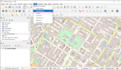
Utilizando herramientas potentes como ArcGIS, QGIS, Google Earth, OSM y WebGIS, ofrezco servicios especializados en:
️>Mapeo GIS y Digitalización
>Georreferenciación y Diseño de Mapas
>Desarrollo de Mapas Web Interactivos
>Análisis y Gestión de Datos Espaciales
️> Procesamiento de Imágenes Satelitales y Datos de Drones
>Creación de Geobases de Datos (SQL, PostGIS, PostgreSQL)
>Modelado de Terreno 3D y Drenaje
Ya sea que trabajes en planificación urbana, monitoreo ambiental, agricultura, infraestructura o investigación, estoy ansioso por dar vida a tu proyecto GIS con precisión, creatividad y visión.
¡Hablemos y hagamos que tus mapas sean significativos!
Informa al freelancer cualquier preferencia o inquietud que tengas con respecto al uso de herramientas de IA en la finalización y/o entrega de tu pedido.
Geospatial Analyst
Idiomas
Traducción automática


