Explorar las categorías
Explora
Fiverr Pro
Español
$
USD
Hola KANNAR ALI
Soy un geólogo experto en ArcGIS, capaz de digitalizar múltiples capas de diversos mapas y recopilar información relevante sobre tipos de rocas, estructuras, fósiles, líneas de falla, zonas de alteración, zonas de mineralización, ríos, carreteras, arroyos y mapas de contornos.
Este proceso incluye el uso de tecnología GPS, investigación de campo y recursos en internet. Luego, los datos serán analizados con software especializado para generar mapas digitales. Para indicar claramente las diferentes formaciones rocosas, el mapa utilizará símbolos y colores geológicos.
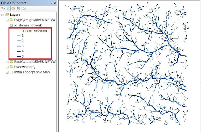
Además, puedo georeferenciar y digitalizar hojas topográficas, mapas antiguos. También puedo crear geo-base de datos, crear shapefiles de cualquier formación geológica, mapas de planes de desarrollo urbano, y mapas de orden de corrientes.
Estoy comprometido a entregar un trabajo de alta calidad que cumpla con tus expectativas.
- digitalización
- arcgis
- mapeo gis
- georeferenciación
- shapefile