Explorar las categorías
Explora
Fiverr Pro
Español
$
USD


Traducción automática
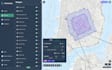
¿Necesitas análisis geoespaciales precisos o conocimientos útiles a partir de tus datos espaciales? Estás en el lugar correcto.
Soy un desarrollador enfocado en GIS con experiencia en análisis espacial, procesamiento de datos y creación de mapas usando Python y herramientas GIS profesionales. Ayudo a transformar datos geográficos en conocimientos accionables y salidas visuales claras.
LO QUE PUEDO HACER:
HERRAMIENTAS Y TECNOLOGÍAS:
Python (GeoPandas, Shapely, Rasterio), QGIS, ArcGIS, GDAL, PostGIS
POR QUÉ ELEGIRME:
Trabajo con empresas, investigadores y particulares para resolver problemas del mundo real usando datos geoespaciales.
No dudes en enviarme un mensaje antes de hacer tu pedido para discutir tu proyecto.
Boston
Idiomas
Traducción automática
Traducción automática
¿Qué tipos de análisis puedes realizar?
Análisis de buffer, análisis de proximidad, uniones espaciales, superposiciones, mapas de calor, agrupamiento y más.
¿Puedes automatizar flujos de trabajo GIS?
Sí, puedo crear scripts en Python para automatizar tareas repetitivas en GIS.
¿Qué formatos de datos admiten?
CSV, shapefiles, GeoJSON, datos raster y más.
¿Recibiré los datos procesados?
Sí, se entregarán todos los resultados (mapas y conjuntos de datos).
¿Puedes explicar los resultados?
Sí, proporciono una explicación o resumen claro según el paquete.
¿Trabaja con grandes conjuntos de datos?
Sí, proyectos grandes y complejos se manejan en el paquete Premium.


