Explorar las categorías
Explora
Fiverr Pro
Español
$
USD




Traducción automática
¡Bienvenido a mi Gig!
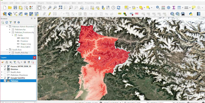
¿Buscas servicios de mapeo GIS precisos, profesionales y de alta calidad? Estás en el lugar correcto. Crearé mapas personalizados y proyectos GIS usando QGIS para ingeniería civil, planificación urbana, investigación y gestión de tierras.
Mis servicios incluyen:
¿Por qué elegirme?
Entregables
Por favor, contáctame antes de hacer un pedido para que podamos discutir los requisitos de tu proyecto y elegir el mejor paquete para tus necesidades.
¡Espero trabajar contigo!
Civil Engineer,AutoCAD,Revit,primaeria p6,plaxis,planswift
Idiomas
Traducción automática
Traducción automática
¿Qué servicios proporcionan?
Ofrezco servicios profesionales de mapeo en QGIS, digitalización GIS, georreferenciación, creación de shapefiles, diseños de mapas, mapeo de carreteras y alcantarillado, mapas de uso de suelo y conversión de datos GIS.
¿Qué debo proporcionar antes de realizar un pedido?
Por favor, proporciona los detalles de tu proyecto, datos del mapa, imagen satelital, PDF, archivo CAD, KML/KMZ o cualquier archivo de referencia. Si no estás seguro, contáctame antes de ordenar.
¿Qué formatos de archivo recibiré?
Puedo entregar archivos QGIS (.qgz), shapefiles (.shp), KML/KMZ, GeoJSON, PDF, PNG, JPG y otros formatos GIS bajo solicitud.
¿Puedes digitalizar mapas a partir de imágenes satelitales o PDFs?
Sí. Puedo digitalizar carreteras, edificios, parcelas, redes de alcantarillado y otras características GIS a partir de imágenes satelitales, mapas escaneados o PDFs.
¿Puedes crear diseños de mapas para impresión?
Sí. Creo diseños profesionales que incluyen título, leyenda, flecha norte, escala, etiquetas y cuadrícula de coordenadas.
¿Proporcionan archivos fuente editables?
Sí. Puedo proporcionar archivos editables de proyectos QGIS y conjuntos de datos GIS si lo solicitas.
¿Puedes trabajar en proyectos GIS de ingeniería civil?
Sí. Puedo crear mapas para carreteras, sistemas de alcantarillado, redes de agua, desarrollo de tierras y otros proyectos de ingeniería civil.
¿Ofrecen revisiones?
Sí. Las revisiones están incluidas según el paquete que elijas. También están disponibles revisiones adicionales.
¿Cuánto tiempo lleva completar un proyecto?
La entrega depende del tamaño y la complejidad del proyecto. Los proyectos pequeños generalmente se completan en 1 a 2 días.
¿Debo comunicarme con usted antes de realizar un pedido?
Sí. Por favor, contáctame primero para que podamos discutir tus requisitos y elegir el mejor paquete para tu proyecto.