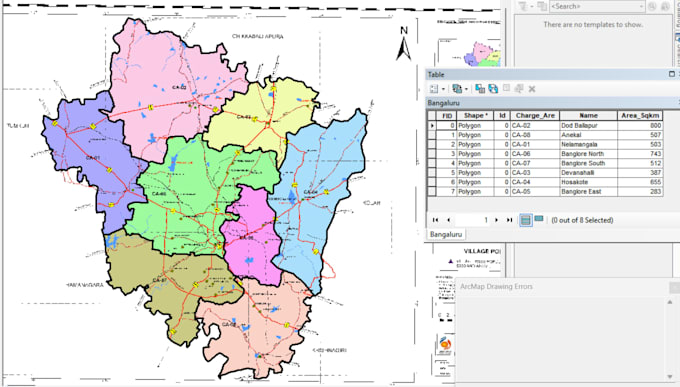
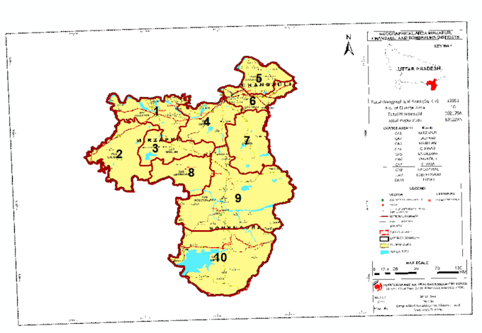
GIS Engineer and Geospatial Specialist with experience in georeferencing, spatial analysis, map digitization, satellite imagery processing, drone image processing, ortho processing, and cartographic mapping.
Skilled in ArcGIS, QGIS, remote sensing workflows, and geospatial data management for accurate GIS outputs and professional mapping solutions.
Services include GIS mapping, raster to vector conversion, shapefile creation, spatial data visualization, and geospatial analysis.
Additionally experienced in responsive website design and frontend technologies.... Lee más