Explorar las categorías
Explora
Fiverr Pro
Español
$
USD

Level 1


Traducción automática
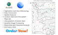
Ofrezco servicios profesionales de GIS usando ArcGIS y Google Earth para ayudar a visualizar, analizar e interpretar datos espaciales para tomar decisiones informadas y soluciones de mapeo perspicaces.
Puedo ofrecer los siguientes servicios:
y muchos más.
No dudes en contactarme para discutir las necesidades específicas de tu proyecto GIS. Garantizo comunicación clara, soluciones personalizadas y entrega a tiempo para ayudarte a alcanzar tus metas con confianza.
Gracias
Level 1
Idiomas
Traducción automática
| (1) | ||
| (0) | ||
| (0) | ||
| (0) | ||
| (0) |
ericfoster810

Estados Unidos
I received a great ROI on Abdullah's work. This helps my work for both the 2024 and 2025 general election campaigns. I highly recommend his work for Analytic projects.
3 días
Tiempo
| (1) | ||
| (0) | ||
| (0) | ||
| (0) | ||
| (0) |
ericfoster810
Estados Unidos
I received a great ROI on Abdullah's work. This helps my work for both the 2024 and 2025 general election campaigns. I highly recommend his work for Analytic projects.
3 días
Tiempo


